Remote sensing of natural hazards (ORISAT)
Ref. 92017
Detect areas at risk, understand the physics of hazards, monitor Earth activity and anticipate disasters using satellites and remote sensing.
- Duration: 7 weeks
- Effort: 14 hours
- Pace: ~2 hours/week
- Languages: French
What you will learn
At the end of this course, you will be able to:
- Recognise the remote sensing data available and its potential.
- Recognise the principles of existing processing methods.
- State your scientific question clearly.
- Choose which data to use according to your problem or object of study.
- Interpret the products obtained (DEM, differential DEM, displacement maps, coherence maps, displacement time series, etc.) and their uncertainties.
Description
Volcanoes, glaciers, landslides, faults: these are all natural objects that can pose a major risk to populations and infrastructures. Over 4 billion people have been affected by natural disasters in the last two decades, and the IPCC report points to a very likely increase in natural hazards as a result of climate change. But can we detect areas at risk? Can we understand the physics of hazards? Can we monitor the Earth's activity? Anticipate disasters?
In this online course on remote sensing of natural hazards, we'll take a look at the big picture. We'll see how satellites, located almost 800 km above the Earth's surface, help us answer some of these questions.
Format
This MOOC will run for 7 weeks and will require 1 to 2 hours of work per week. You will find videos of scientists and specialists, MCQ-type exercises, illustrations, etc. This course is available in French, English and Spanish.
Prerequisites
No pre-requisites. A university entrance qualification is recommended and a scientific curiosity is preferable.
Assessment and certification
This MOOC is based on the principle of self-assessment: each participant takes one or more weekly quizzes. A badge certifying completion of the course is awarded at the end of the MOOC if a minimum score of 60% is achieved.
Course plan
- Natural hazards and remote sensing
- Remote sensing data
- Which method for which application?
- General principles on change detection
- Principles of InSAR
- Time series
- Principles of Image Correlation
- Measuring variations in elevation: photogrammetry
- Earthquakes and remote sensing
- Volcanoes and remote sensing
- Landslides
- Glaciers and remote sensing
- AI: A real revolution or just a fad?
- Monitoring: towards early warning?
Course team
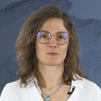
Sophie Giffard-Roisin
Categories
Researcher in artificial intelligence applied to remote sensing, ISTerre, IRD.
Organizations
Produced by
Our partners
License
License for the course content

Attribution-NonCommercial-NoDerivatives
You are free to:
- Share — copy and redistribute the material in any medium or format
Under the following terms:
- Attribution — You must give appropriate credit, provide a link to the license, and indicate if changes were made. You may do so in any reasonable manner, but not in any way that suggests the licensor endorses you or your use.
- NonCommercial — You may not use the material for commercial purposes.
- NoDerivatives — If you remix, transform, or build upon the material, you may not distribute the modified material.
License for the content created by course participants
Attribution-NonCommercial-NoDerivatives
You are free to:
- Share — copy and redistribute the material in any medium or format
Under the following terms:
- Attribution — You must give appropriate credit, provide a link to the license, and indicate if changes were made. You may do so in any reasonable manner, but not in any way that suggests the licensor endorses you or your use.
- NonCommercial — You may not use the material for commercial purposes.
- NoDerivatives — If you remix, transform, or build upon the material, you may not distribute the modified material.